
Use or review the journey
Accept the journey, request a targeted review or reject it.
Railway Data Interpretation Engine
Using time-stamped GNSS positions, a progression signal—often odometry—and a railway map, MBDD Rail identifies the train’s route and positions the journey by line, track and KP. Supplied events can then be associated with the correct location. The same engine can feed a product with a usable journey or qualify that journey: evidence-backed results, candidates, diagnostics, evidence and sections requiring review remain distinct.
Required railway map versioned map of the relevant section, proposed by MBDD-Solutions or provided by the customer.
Enrichments when available supplied source events and rules; operational objects according to map coverage.
The starting point
Events and operational data are often distributed across several departments or systems. Without waiting to assemble everything, MBDD Rail begins qualification from the available baseline; sources opened up later enrich the journey.
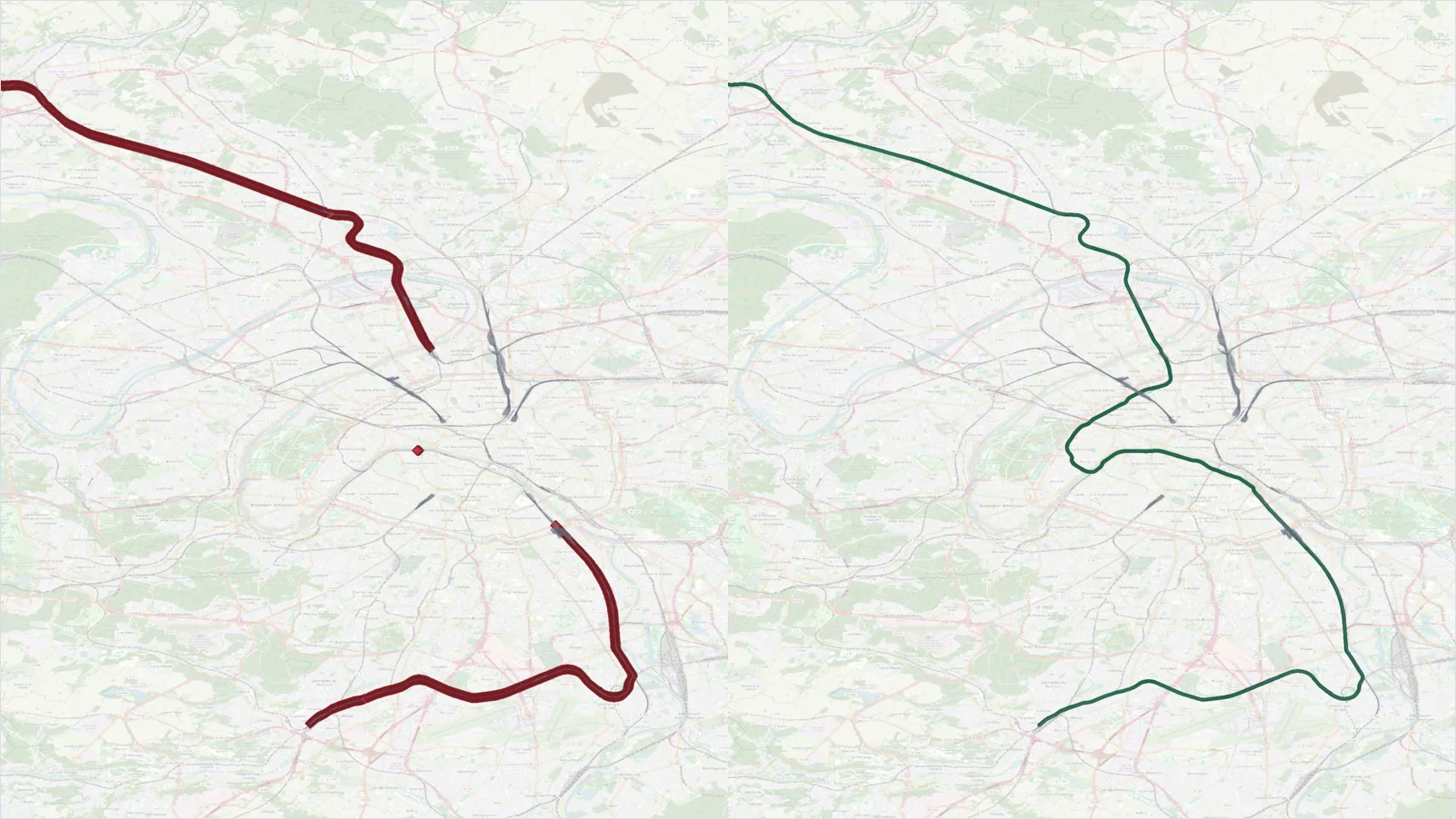 Raw GPS trace
Qualified railway journey
Raw GPS trace
Qualified railway journey
The transformation
Partner-side observation baseline
Supplied source events and rules · operational objects covered by the map
Route identification
Compare · select · supportRoute, position and events
Results and decisions
Accept the journey, request a targeted review or reject it.
Focus review on candidates, inconclusive sections and recurring patterns.
Use its railway position or identify the missing information.
Events and rules
MBDD Rail preserves the origin of supplied events, associates them with the qualified journey and distinguishes what it receives from what it issues.
Supplied by onboard equipment, infrastructure or an external system; its origin, timestamp and coverage remain attached to the source.
Issued by MBDD to flag an ambiguity, break, limit or section requiring review, together with the corresponding evidence.
Issued only when a partner-supplied rule applies and is triggered; the rule and the data used remain traceable.
An upstream detection becomes a located railway fact.
The engine does not process raw images, video or point clouds and does not replace source systems. It qualifies only supplied events covered by the scope; missing data remains non-assessable.
How we work together
MBDD-Solutions supplies and maintains the engine; the partner integrates it into its product and retains the relationship with its users.
Verify within a bounded scope that the engine fits your product, data flows, infrastructure reference and intended decision.
Evaluate a representative use caseIntegrate the selected mode, freeze the contracts and verify conformance, performance and recovery.
Explore the programmeLicense the engine for an explicitly named partner product, uses, environments and volumes.
Bounded rights. This model does not automatically include source code, white labelling, a perpetual licence or unrestricted redistribution.
Prepare for productionOne engine, two technical modes. Embedded Runtime and Engine API are assessed during qualification; deployment and redistribution rights remain contractual.
OEM Technical Qualification
Present the need, the data flow to interpret and, where applicable, the target architecture. We frame the scope, results to verify and expected verdict.