MBDD Studio Cartographique

Build your mapping applications without coding

Bring your GIS data, plans and 3D views together in applications tailored to your work. Your teams explore assets, prepare visits and share observations, from office to field.

Web application, online or on your own servers (on-premise).Sign in with your credentials to open your organisation’s workspace in your browser.

Discover Studio with us
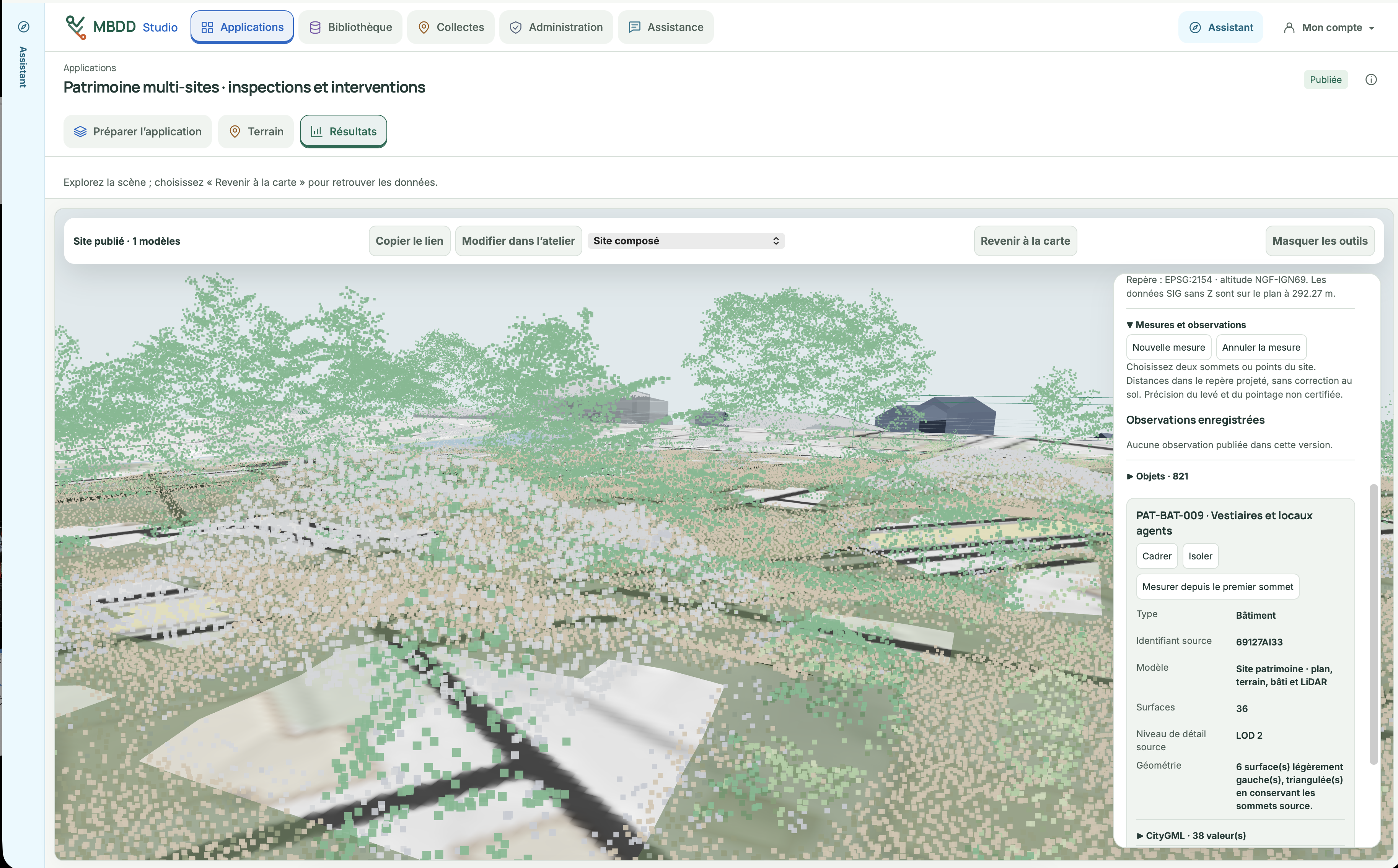
Explore a site in 3D and inspect its objects’ information.MBDD Studio screenshot · “Multi-site assets: inspections and interventions” application.

For GIS teams and services responsible for assets, infrastructure and business activities.

Turn your data into working tools

Track equipment, analyse an area or prepare an intervention: use the visual editor to assemble the maps, object details, dashboards and forms each team needs.

Combine 2D maps, plans and 3D scenes to understand a site and find its information. Publish the application, choose who can view or edit, then adapt the views and forms as your needs evolve.

An inspection campaign, from preparation to results

Select the places to visit on the map, the form and the instructions to share. Your field teams open their assignment, record observations and add photos. You review their submissions in the application.

See Studio on a phone
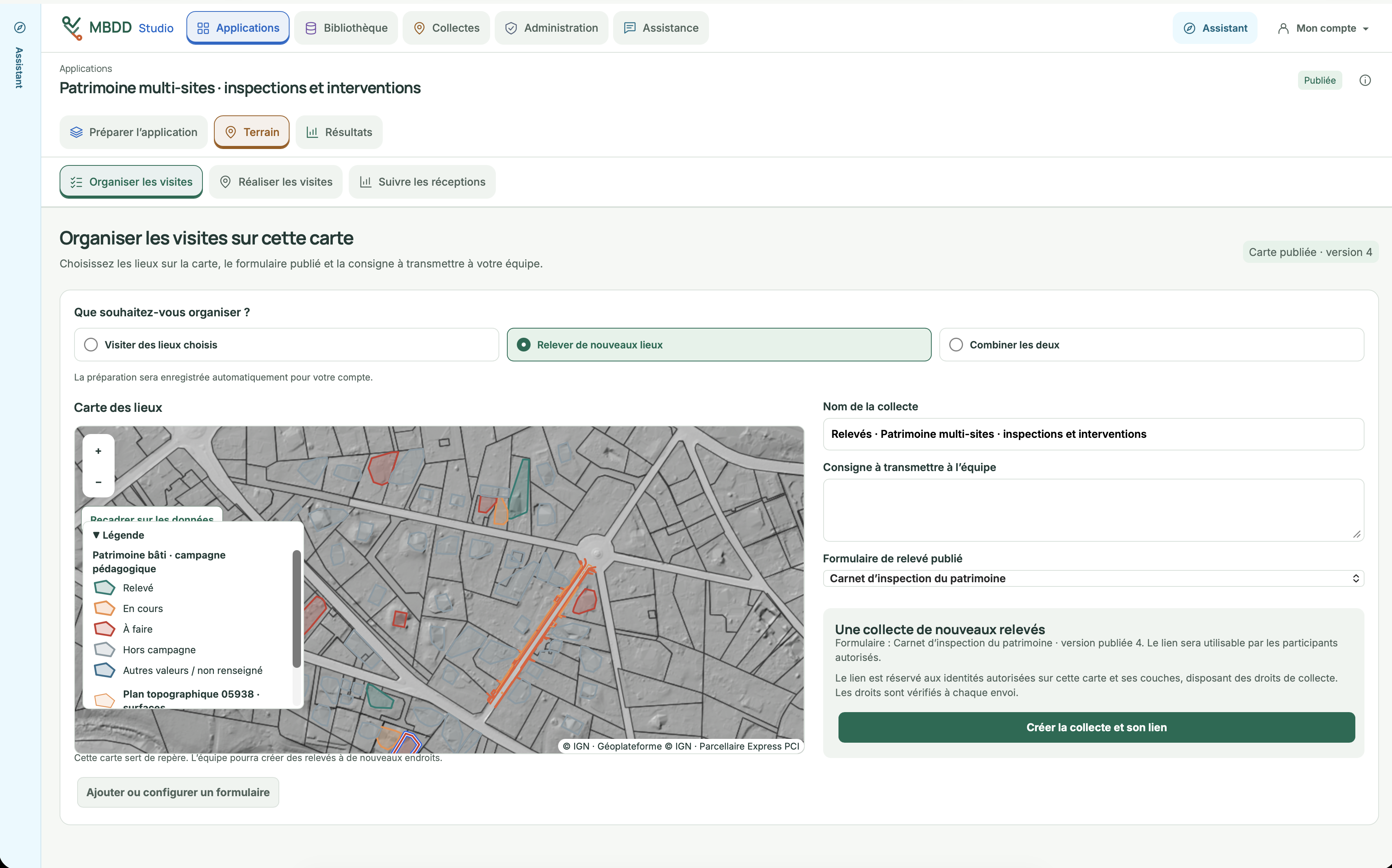
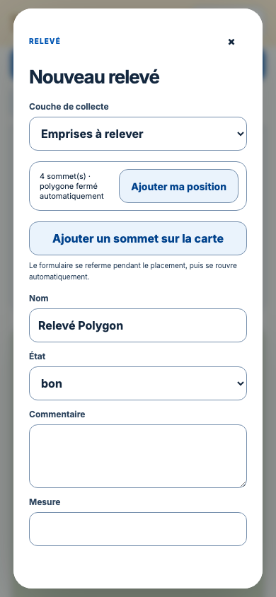
MBDD Studio: preparing a collection with a map of locations, instructions and an observation form.
Prepare visits from the map your teams use.MBDD Studio screenshot · basemap © IGN — Géoplateforme, Parcellaire Express PCI.

MBDD Studio Terrain

Your business tools go with you into the field

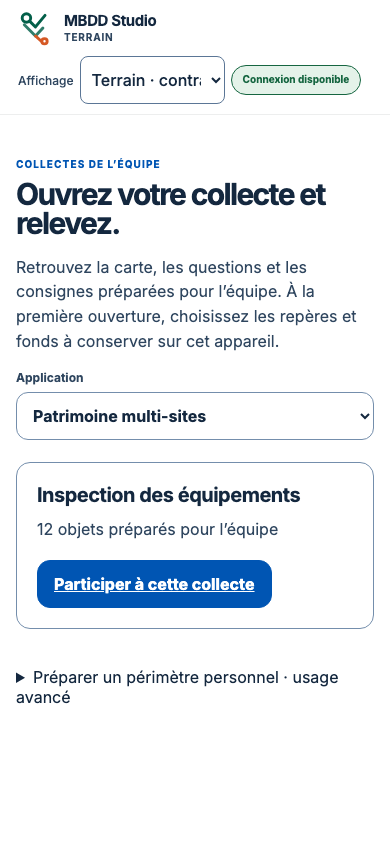
On a phone or tablet, your field teams open the collections prepared in Studio and record their observations on site.

  • The right information on siteFind the locations, map, instructions and collection form.
  • Observations ready to useRecord points, lines or areas, complete forms and attach photos to observations.
  • Keep working without a connectionTake prepared data with you, save on the device and synchronise when connectivity returns.

Practical details

How do you access Studio?

Studio runs in a browser. Online, sign in with your credentials to your organisation’s workspace to create or use applications according to your permissions. You can also install Studio on your own servers (on-premise). Map sources, access and backups are configured for the chosen environment.

Which data can you bring together?

Connect your GIS sources and mapping services, import files and join your business tables. Studio also supports viewing DWG/DXF plans, IFC or CityGML models and LAS/LAZ point clouds, within the supported formats and profiles.

What can you do without a connection?

With Studio Terrain, take the data and basemaps prepared on your device. Complete observations and add photos offline, then synchronise when connectivity returns. We verify this workflow with your devices.

How do you start a project?

Together, we define a first application, its users and data sources. We prepare its configuration, launch and onboarding for your teams.

Let’s discuss your application

Asset management, field visits or territorial analysis: tell us about your use case. We will show you how to turn it into an application with Studio.

Contact us

Or email us directly at contact@mbdd-solutions.com